Western USA 2003
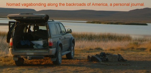
Rim of Joseph Canyon to LoLo Trail in the Bitterroot Mountains
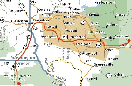
Incredibly beautiful drive through steep canyons and wheat fields to the town of Lewiston, next to Clarkston on the Idaho/Oregon border. Big town and drove around a while looking for a library even asked around and no one knew. Finally found someone who knew it was on the outskirts of town along an old shopping mall strip in an old building. After checking email went to a Chinese restaurant for a sit down meal that included fresh kimchi. There was a sign out front that said "homemade kimchi".
Continued on Eastward to the Nez Perce reservation and stopped at a fairly large National Park Service welcome center that included a movie and exhibits and gift store. Talked with the older gentleman running the gift shop who was from Mass. and very knowledgeable about American history, he is a reformist who enjoyed overturning old ideas about the "wild" west being settled long before Europeans arrived. Being from a younger generation such ideas are not so revolutionary indeed standard cannon but for his generation it must be a more significant revelation and he seemed pretty excited about it.
Followed route 95 into the reservation which looks big on the map hoping to see lots of Indian poverty and squalor. There was mostly Indians who drive very fast and aggressive I was literally driven off the road by one "warrior" brave behind the wheel of an old Buick. But most of the towns are "white people" with no Indians at all. They must lease the land or have some old treaty because you would never know you were on a reservation.
Took a detour off 62 at the farming town of Nez Perce (no Indians) to the town of Kamiah and ended up on the scariest road (marked "4wd") I have ever been on. Sharp S-curves along a steep cliff with no guard rails and newly laid pebbles and a steep descent such that every turn is a blind curve and it feels like slipping over the edge would be a natural course if another car was to appear. This road went on for a good hour and I only passed one vehicle. It has to be a reservation road as no road in the USA could be so treacherous and still be legal!
On to route 12 and up into the wetter and greener Bitterroot Mountains along the Clearwater river. This is another amazing road that was only recently built due to the incredible roughness of the terrain and length of over 70 miles through some of the most rugged mountains in the USA. Camped along the river not 5 miles from where Lewis and Clark camped to the exact day Sept 15th many years ago on the way westward along the LoLo trail.
Store-bought chicken and potato salad for dinner along with left-over kimchi from lunch. Some people camping nearby with dogs, they didn't come begging for kimchi. Campsite is right off route 12 next to the Lochsa river about 30 miles into the mountains. Tomorrow I will go to the mountain tops to find the original LoLo trail and retrace Lewis and Clark.
Posted by stbalbach at September 15, 2003 01:29 AM